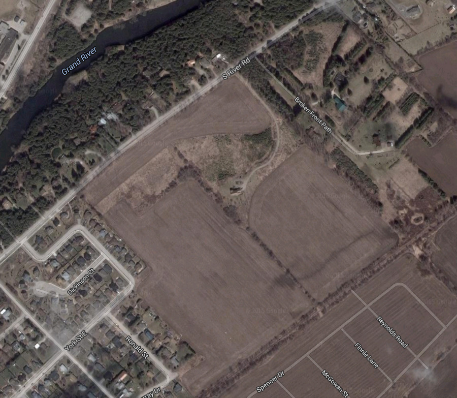
The inevitable march of progress is at our door... or at least across the street. When we bought this house we predicted that population growth in Elora would continue, and that the field across the road from us would eventually be turned into a subdivision. We just received notice in the mail that the zoning change is coming soon. If you hover your mouse cursor over the image, you should see the planned subdivision overlayed on top of the aerial photo. Our property is the one immediately to the left of "R1A" at the top of the image.
It looks like they are planning to put a combination of apartments (or possibly rowhouses) in the R3 zone across the street from us, and a storm water management pond in the OS zone. Given how long it has taken them to complete the subdivision at the bottom of this image (where Google has the streets outlined but does not have recent enough aerial photographs to show the houses), it will probably be many years before this new subdivision is approved and completed... but change is coming.
I will miss being able to set up my camera in the middle of the field to take night shots, view the stars, or observe wildlife. However, it will be a convenient spot for the kids to go trick-or-treating, and having a park (the other OS zone in the centre of the subdivision) so close will be fantastic. I'm hoping that the change will also come with the option to run fibre directly to my home, but maybe I'm just dreaming on that one.
Technical Details: This picture is a combination of Google Maps and a diagram from the Township of Centre Wellington.
Hosted by theorem.ca