⇍ October 17th, 2004 ⇏
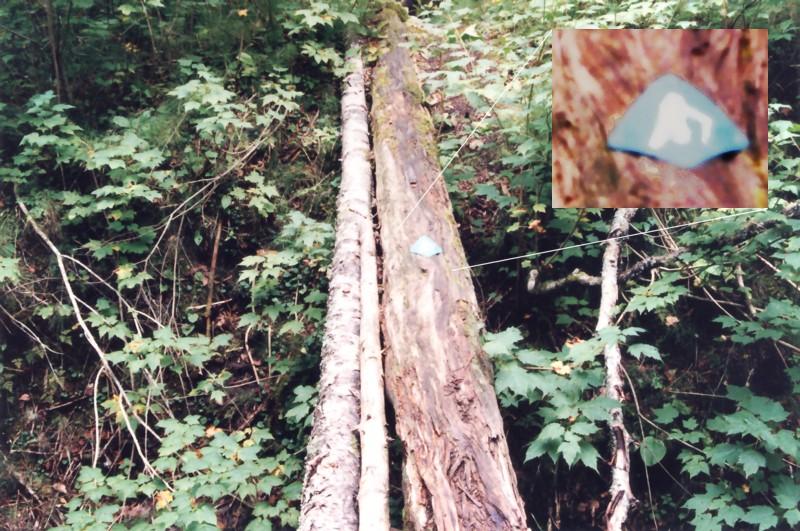
This week Angela and I are embarking on a northern adventure. We are driving up to Pukaskwa National Park and we will attempt to camp there in the cold October air. Since I'm not around, I can't do a real picture this week, so I am going to launch a preemptive strike here with a picture I took the last time I was on the north shore of Lake Superior. I think this picture is pretty funny. Mum, Alix, Susan and I were on this trip, and we stopped in at one of the many parks along the way. I can't actually remember which one this was... Old Woman Bay perhaps? Anyway, we decided to hike along one of the "easy" trails. Eventually we came to a deep ravine. There was no way across it except for these logs that had been placed there. What I found most amusing was that there was a sign (which I have enlarged and enhanced for easy viewing) that was obviously placed on the makeshift bridge to indicate that it was indeed the correct route to take. After a short debate we decided to continue on, and we all made it across the slippery half rotten logs.
Hosted by theorem.ca