We actually started our New Zealand journey on the north island, so I thought I should post at least one picture from up there. The geography of New Zealand is very interesting. The north island is volcanic in origin, with volcanoes and cinder cones dotting the landscape, while the south island consists of a large tectonic thrust mountain range, and large flat areas formed by erosion.
On our third day in New Zealand we visited the Te Puia geothermal valley and Maori cultural center near Rotorua. It was a great way to learn about Maori history, culture, and to see some cool geology in action. I even got to perform a haka!
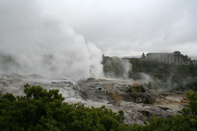
The valley is located over a hotspot in the Earth's crust, so groundwater gets heated to the boiling point underground, sending steam and scalding hot liquid up to the surface. We saw hot mud pools bubbling at a temperature of 90 degrees C, sat on rocks that are nice and warm all year round, and even saw a continuously boiling pool of water that the Maori people use as a natural barbequeue to cook food!
The dominant feature of the area is a pair of geysers that flare up simultaneously about a dozen times a day, at unpredictable times. These geysers actually spray cold water, but they are powered by subterranean steam. The weather was cold and rainy that day, but I managed to get a few nice photos of the valley, including this one below of the geysers doing their thing.
Technical details: This image was taken with my Rebel XT + kit lens at 18mm, ISO 400, f/8, for 1/400th of a second.
That's very impressive! So is your photo map.-- Mum at 8:56pm, Wednesday June 24, 2009 EST
Hosted by theorem.ca